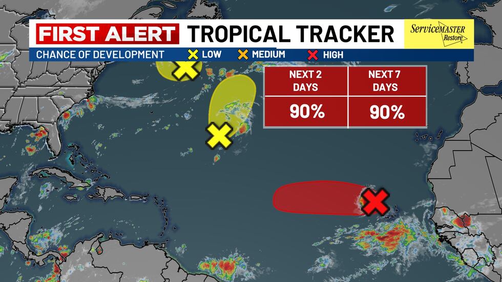
CHARLESTON, S.C. (WCSC) – The National Hurricane Center is monitoring a system expected to become the first hurricane of this year’s Atlantic hurricane season by week’s end.
Live 5 First Alert Meteorologist Lexie Horvath said the system, currently labeled Invest 97-L, is expected to become a tropical depression within days and further development is expected as the system moves across the warm waters of the Atlantic.
When it reaches tropical storm intensity, which forecasters are now saying could happen before noon Monday, it will take the name Erin and become the fifth named storm of the season.
The system is sitting just to the west of the Cabo Verde Islands. Only a small increase in the organization could lead to the formation of a tropical depression before the low moves near or across the Cabo Verde Islands Monday.
The National Hurricane Center is monitoring a system expected to become the first hurricane of this year’s Atlantic hurricane season by week’s end.(Live 5 News)
But even in the unlikely event that a tropical depression does not form over the next day or so, environmental conditions appear to favor development as it moves west-northwestward at 15 to 20 mph across the eastern and central tropical Atlantic.
There is a 90% chance of development into at least a tropical depression within the next 48 hours as of Monday morning.
Copyright 2025 WCSC. All rights reserved.