FORT WAYNE, Ind. (WPTA) – *This live blog will be updated periodically throughout Sunday afternoon and evening providing weather updates.*
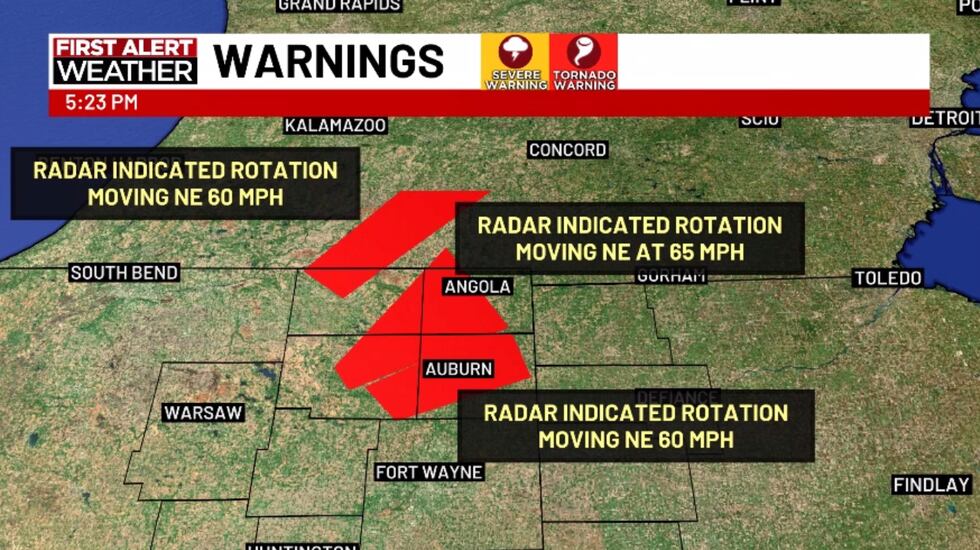
5:23 PM Update, March 30, 2025: Another TORNADO WARNING issued for Noble, DeKalb, and Steuben counties until 5:45 PM.
Radar indicated rotation, meaning no confirmation of a tornado at the time of warning, but the potential is there. Caleb has the latest on 21Alive!
Tornado warnings in effect(WPTA)
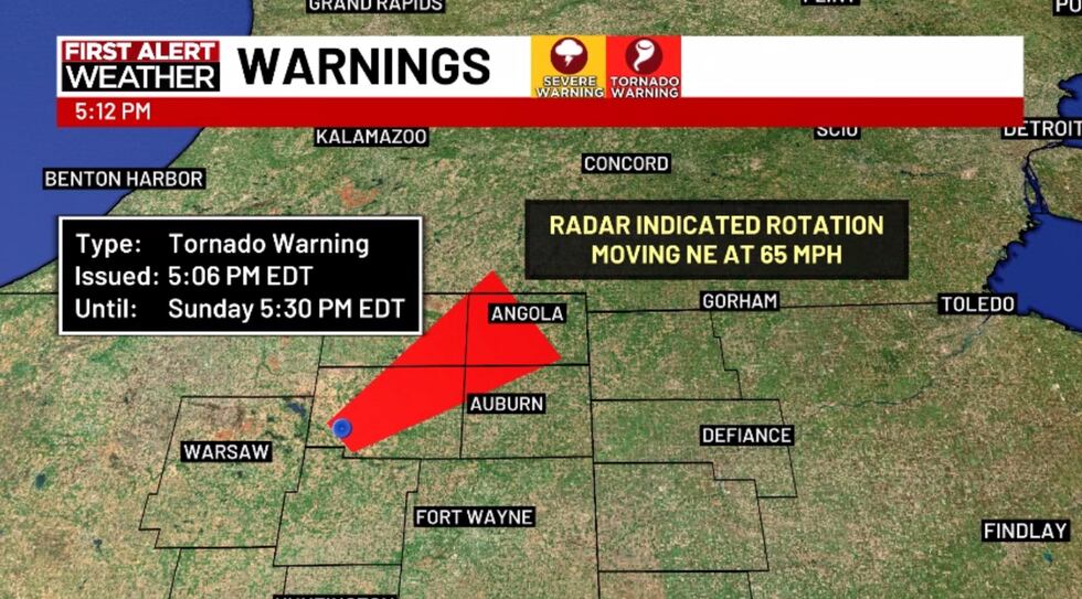
5:14 PM Update, March 30, 2025: A TORNADO WARNING issued for Noble, DeKalb, LaGrange, and Steuben counties until 5:30 PM.
Radar indicated rotation, meaning no confirmation of a tornado at the time of warning, but the potential is there. Caleb has the latest on 21Alive!
Tornado warning issued until 5:30 pm(WPTA)
5:08 PM Update, March 30, 2025: Another large Severe Thunderstorm Warning was issued for the rest of the counties in Northern Indiana for potential wind gusts as high as 70 mph with hail up to an inch in diameter (size of a quarter). Again, these warnings indicate potential, but not a guarantee they will occur. A quick spin-up is also possible!
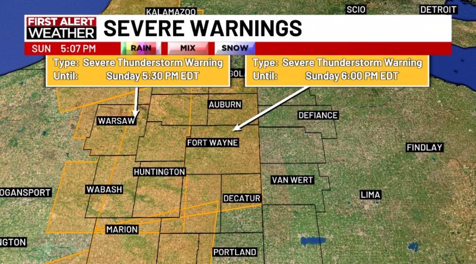
Severe thunderstorm warning until 6pm(WPTA)
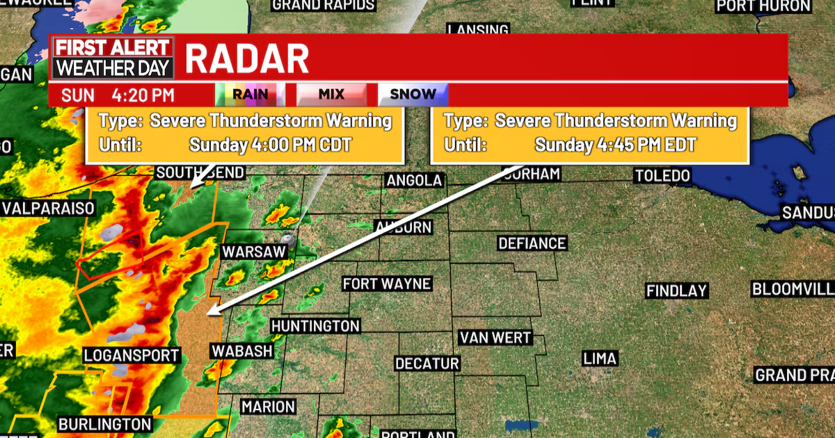
4:45 PM Update, March 30, 2025: A large Severe Thunderstorm Warning was issued for all counties west of Fort Wayne for potential wind gusts as high as 70 mph with nickel-sized hail. A quick spin-up is also possible.
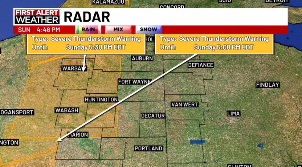
Severe thunderstorm warning until 5:30 pm(WPTA)
4:35PM Update, March 30, 2025: Live weather update
4:25PM Update, March 30, 2025: The line of severe thunderstorms is just about to move into the western parts of Kosciusko and Wabash Counties.
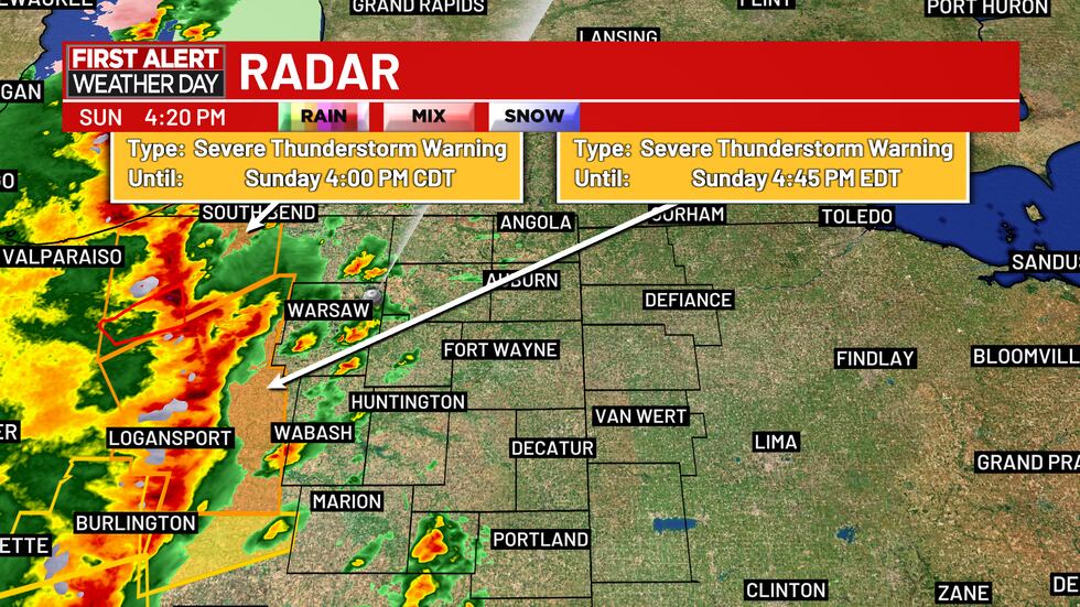
radar update 03/30/2025 4:25pm ET(wpta)
The National Weather Service has seen reports of 60-75mph wind gusts with these storms, as well as a few areas of rotation. First Alert Radar is showing estimated wind speeds as high as 70mph. Stay inside as storms pass over you today!
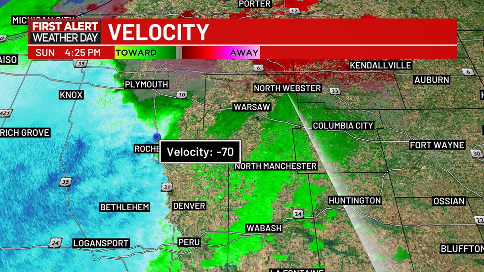
Radar velocity estimated wind speed 03/30/2025(wpta)
3:15PM Update, March 30, 2025: The line of thunderstorms we are tracking are currently moving into Indiana from Illinois. Almost the entire line of storms has a severe thunderstorm warning issued ahead of it. The primary concern with the severe thunderstorms right now is damaging wind gusts upwards of 60 to 70mph in some places.
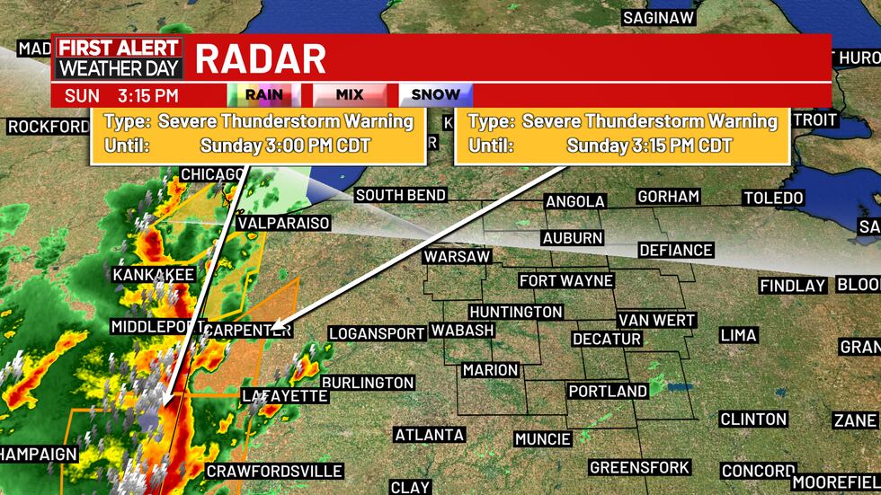
First Alert Radar 3:15pm Sunday, March 30, 2025(wpta)
2:15PM Update, March 30, 2025: The 21Alive First Alert Weather Team issued a First Alert Weather Day for Sunday, March 30 because of the potential for severe thunderstorms. At 2:15pm ET, the National Weather Service issued a Tornado WATCH for all of Northern Indiana until 8pm Sunday. At the time of this update, this watch DOES NOT include any Ohio counties within 21Country.
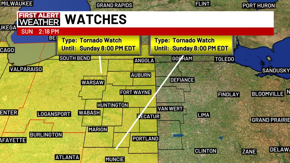
Tornado Watch Northern Indiana until 8pm Sunday, March 30, 2025(wpta)
Reminder, a watch means the ingredients exist for severe storms to form, but a warning means that a severe storm is either happening, or about to happen.
Copyright 2025 WPTA. All rights reserved.